SparkのビデオとログからDashWareで様々なデータを重ね合わせたビデオが作ることが出来ます。詳しくは以前の記事を御覧ください。
ひとつ問題が残っています。それは高度を表示すると海抜表示になってしまいます。希望としては離陸時を0とした相対的なグランドレベルの高度が表示したいです。そのための方法が公式FAQに書かれています。以下、その抜粋です。
Altitude is based on sea level, how do I make it ground-based?
How to make ground based altitude–it will be a single step at the start of every project for you:
-Figure out what the ground altitude is (for example, 750 meters)
-Make a clone of the data profile you are using, so that you can edit it. This can be done in the Data Profile Editor (File Menu > Edit Data Profiles…)
-In this clone add a Math Calculator (bottom left area) that takes the Altitude in meters and subtracts 750. Call this new channel “Ground Based Altitude”, or whatever you want.
-Map your new channel to our appropriate “Positional \ Ground-Based Altitude” type, based on your desired units.
-Save the new data profile.Every time you make a change to a data profile, or want to use a different data profile in a project, you need to remove then re-add your data file to the project. So re-add your data file to your project and select your new cloned data profile.
Add a gauge to your project that shows ground based altitude, or edit an existing gauge and change the gauge’s input data type to ground based.
これがなかなかに難解で実現できるまでに随分と試行錯誤が必要でした。実際にわたしが行った手順を紹介いたします。
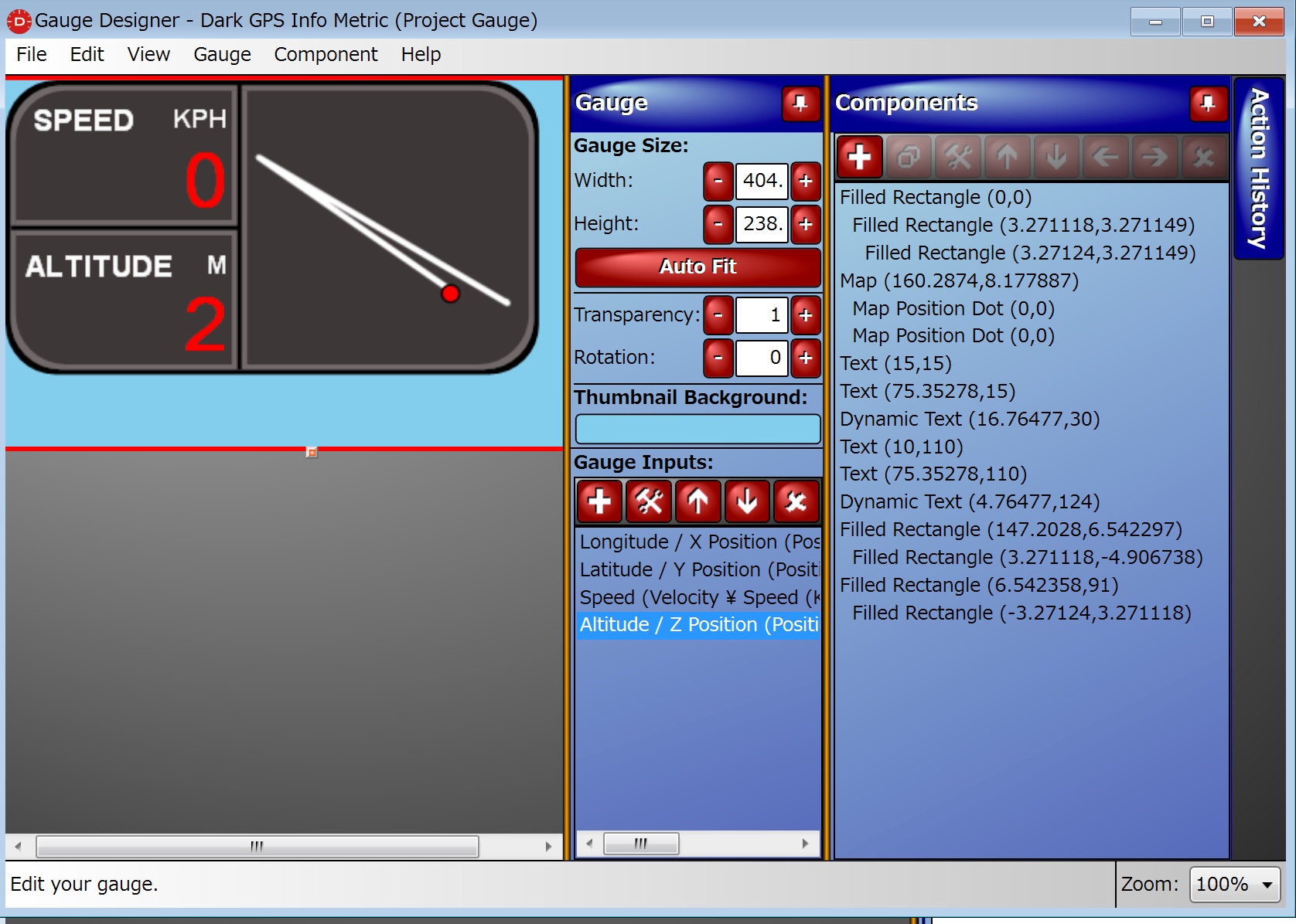
– FAQの手順に入る前に使用しているゲージの編集画面から目的の数値のData Typeを調べておきます。ビデオ画面上のゲージをダブルクリックすると下の画面が開きます。高度に割り当てられているはAltitude / Z Position (Meters)であると確認できます。
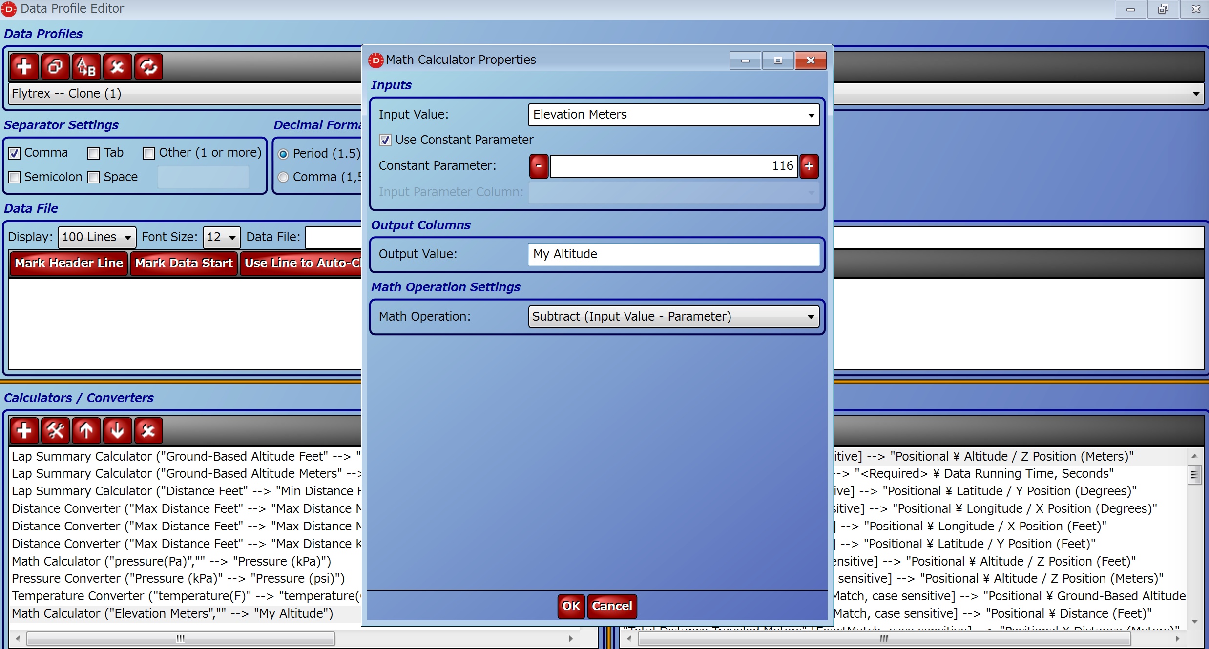
– まずグランドレベルの高度を認識します。海抜何メートルから離陸したかということでデータを見ていればすぐにわかります。わたしの場合は116メートルでした。
– Data Profileをコピーし編集を行う。File/Edit Data Profileを開きます。前回の記事で紹介したCSVファイルでは自動的にFlytrexというData Profileが使われますので、それをクローン(上の方の左から二つ目のアイコン)します。Flytrex — Clone (1)というファイルが出来るので、それを編集します。
– 左下のウインドウでMath Calculatorという項目を追加します。Input ValueにElevation Meter、Contstanに116と入力Output Valueは自分の定義値、My Altitudeなどとします。Math OperationはSubtract(Inout Value – Parameter)です。これで目的の値がMy Altitudeという名前で得られます。
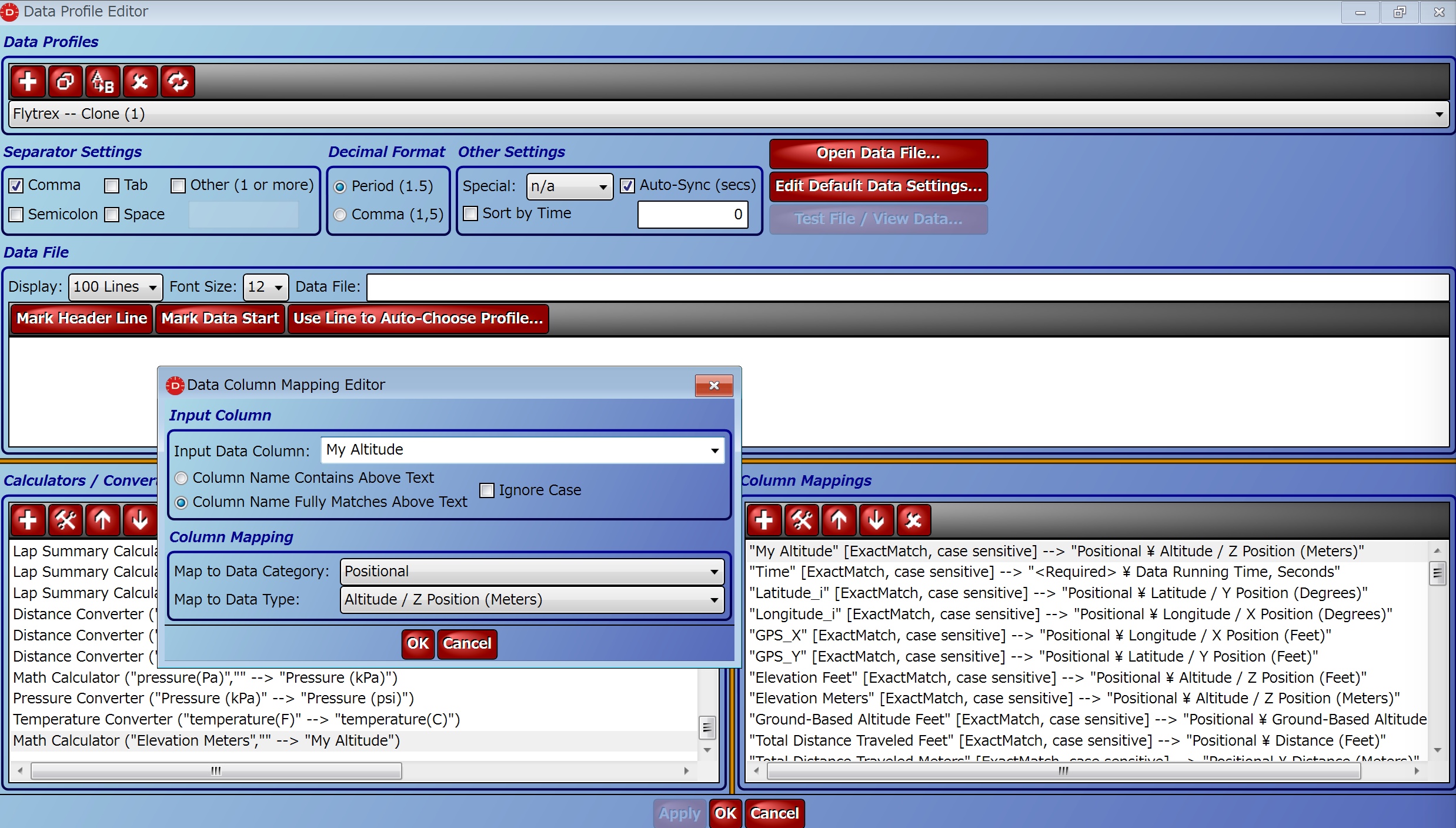
– 次に右側のウインドウで得られた値をData Typeにマップします。Input Data ColumnをMy Altitude、Map to Data CategoryをPosition、Map to Data TypeをAltitude / Z Position (Meters)で作成します。実はAltitude / Z Position (Meters)はすでに存在しているので、新しく作った項目を一番上に持ってきて正しく選択されるようにします。
Data Profileを保管したら、いちどProjectからData Fileを削除して、新しいData Profileを使ってCSVファイルを読み直せば目的の高度値が得られているはずです。
[…] 「DashWare+Sparkビデオで高度表示をグランドレベルにする」 […]